 |
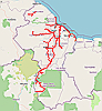
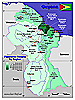
Guyana, Main Roads
|
(shp) |
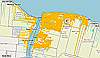 |
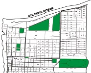
Metro Georgetown, Street Centerline Without Address Ranges
Source: Data downloaded from Open Street Map. |
(shp) |
 |
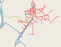
Linden, Street Centerline Without Address Ranges Source: Data downloaded from Open Street Map. |
(shp) |
 |
Kwakwani, Street Centerline Without Address Ranges Source: Data downloaded from Open Street Map. |
(shp) |
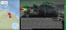 |
Strory Map. Guyana's Linden to Lethem Road: A Metaphor for Conservation and Development Source: (http://www.focusongeography.org/publications/photoessays/guyana/index.html) |
|
 |
Building Footprints in Guyana OpenStreetMap contains roughly 248.8 thousand buildings in Guyana. This is based on AI-mapped estimates and amounts to approximately 88% of the total buildings. Further editing of the footprints is necesary but it is a good starting point for various types of analyses. Source: Humanitarian Data Exchange. Originally derived from Open Street Map. |
 |
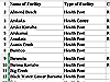
List of Schools in Guyana, 2019. (xls). Source: List of schools downloaded from Guyana's Ministry of Education's website, August 2019. Shapefile generated from list by GuyNode. |
|
 |
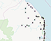
Schools in Region 1 (shp) Source: List of schools downloaded from Guyana's Ministry of Education's website, August 2019. Shapefile generated from list by GuyNode. |
|
 |
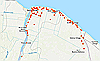
Schools in Region 2 (shp) Source: List of schools downloaded from Guyana's Ministry of Education's website, August 2019. Shapefile generated from list by GuyNode. |
|
 |
Schools in Region 4 (shp) Source: List of schools downloaded from Guyana's Ministry of Education's website, August 2019. Shapefile generated from list by GuyNode. |
|
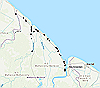 |
Schools in Region 5 (shp) Source: List of schools downloaded from Guyana's Ministry of Education's website, August 2019. Shapefile generated from list by GuyNode. |
 |
GuyNode's Covid-19 Dashboard, GuyanaGet a big picture view of the Covid-19 situation in Guyana from GuyNode's dashboard.Data Source: World-O-Meter; Health.gov.gy; Our World in Data, Covid-19 |
|
Microsoft Covid-19 Tracker, GuyanaBing's Covid19 Dashboard. Tracks Covid-19 spread on a daily basis. |
| |
 |
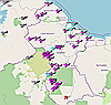
Distribution of Covid-19 Cases, Guyana, May, 2020Cumulative Covid-19 Cases by Regional Democratic Councils as of May 7th, 2020. Region 4 and Region 10 were the regional hot spots.Source: Map created by GuyNode using data from Health.gov.gy |
(shp) |
 |
List of Health Facilities in Guyana, 2019 (xls) Source: List of health facilities downloaded from Guyana's Ministry of Health's website, August 2019. List converted to xls format by GuyNode. |
|
 |
Guyana Demographic and Health Survey, 2009
Contains many tables that can be mapped by administrative regions |
 |
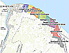
Tourist Street Map of Georgetown (pdf)
Download and use to plan your trips around Georgetown. |
|
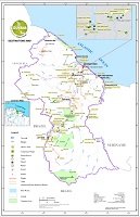 |
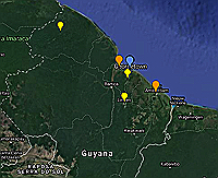
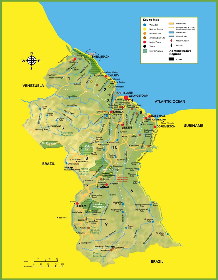
Tourist destinations map, Guyana Map showing popular, sight-seeing destinations throughout Guyana Source: Guyana Lands and Survey Commission |
|
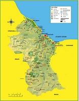 |
Tourist map, Guyana Map showing popular, sight-seeing destinations throughout Guyana Source: OntheWorldMap.com |
|
 |
Fishbrain, Sports Fishing Sites Search for popular, sports fishing destinations throughout Guyana Source: Fishbrain.com |
|
 |
Climb Mountain Peaks in Guyana Explore over 600,000 mountains from around the world. Find the best peaks to climb in Guyana based on your experience, goals, and location. Source: https://peakery.com |
|
 | Airports and Airfields in Guyana(shp) Shapefile created by GuyNode.com. Data Source: The Humanitarian Data Exchange (HDX), Google Earth, Bing Maps. |
 |
Ports of GuyanaMajor Ports of Guyana |
|
 |
Potable Water Zones on Guyana's Coast
Maps are presented in pdf format. Interactive maps available for account holders. |
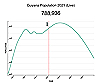 |
Estimated Total Population of Guyana, 1980-2025 |
|
| Preview | Population and Housing Census Source: Source: Bureau of Statistics, Guyana |
|
 |
Population Density by Regions, Guyana Source: www.geo-ref.net/pdf/guyana.pdf |
|
| Village Population | Village Population by Ethnicity, Region 1, 2012 Source: Bureau of Statistics, Guyana |
|
| Village Population by Ethnicity, Region 2, 2012 Source: Source: Bureau of Statistics, Guyana |
||
| ESRI Datasets | Esri Standard Demographics dataset for Guyana Source: : ESRI |
| Moody Analytics | Moody's Assessment of Guyana's economy. | |
| Federal Reserve Bank Statistics | Federal Reserve Bank Statistics for Guyana | |
 |
World Bank Data
GDP, Population, School Enrollment, CO2 Emissions, GNI, Life Expectancy at Birth, etc. |


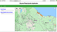 |
Guyana Place Locator Application
Search Google and GuyNode's databases for gazetted and local place names in Guyana. Website Creator: GuyNode.com |
|
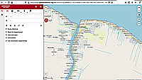 |
Search for Places / Get Rudimentary Driving Directions Search for places in Guyana using Open Street Map. Get driving directions to and from different communities (e.g., Agricola to Ann's Grove) or to streets within communities (e.g., Camp Street, Georgetown to Third Street, Eccles). Directions to house addresses not yet available for Guyana. Website Creator: Open Route Service. |
|
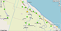 |
Place Search, National Gazeteer of Guyana Search for places in Guyana using the online national Gazeeter of Guyana. Website Creator: Guyana Lands and Survey Commission. |